Satellite images show extent of flooding in Florida’s Big Bend
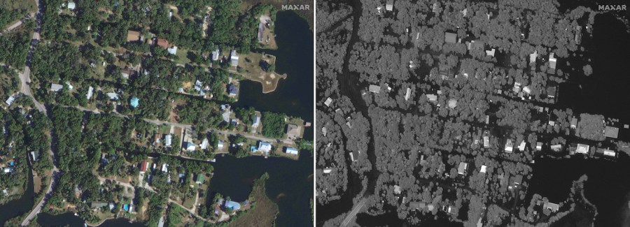
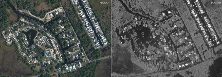
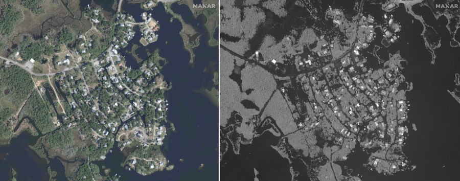
Satellite images are showing the devastating impact Hurricane Idalia had on Florida’s Big Bend area.
Idalia made landfall just before 8 a.m. Wednesday in Florida’s Big Bend region as a Category 3 hurricane with 125 mph sustained winds. Idalia was downgraded to a tropical storm by Wednesday afternoon. However, it continues to produce heavy rainfall and life-threatening flash flooding in portions of eastern North Carolina.
Some areas have gotten as much as 10 inches of rain and a 15-foot storm surge, according to Federal Emergency Management Agency Administrator Deanne Criswell. The images from Maxar Technologies show extensive flooding in Florida’s Big Bend region — one of the areas in the state that saw the most damage from Idalia — compared to photos of the area captured in January.

This combination of satellite images provided by Maxar Technologies shows a portion of the Big Bend area in Florida on Jan. 12, 2023, and the same area, right, Aug. 30, 2023, after Idalia’s catastrophic wind and rain swept the area. (Satellite image ©2023 Maxar Technologies via AP)

Another combination of images shows more of the Big Bend area on Jan. 12, 2023, and the same area, right, on Aug. 30, 2023, after the storm caused flooding to the area. (Satellite image ©2023 Maxar Technologies via AP)

More images show another portion of the Big Bend area on Jan. 12, 2023, and the same area on Aug. 30, 2023, after Idalia. (Satellite image ©2023 Maxar Technologies via AP)
Copyright 2024 Nexstar Media Inc. All rights reserved. This material may not be published, broadcast, rewritten, or redistributed..


