La Niña is set to arrive later than expected: Here’s when
(NEXSTAR) – La Niña watch is on, but the wait for her to arrive may be longer than initially anticipated.
When the Climate Prediction Center first issued a La Niña watch in June, the national meteorologists said the climate pattern was favored to take hold between July and September. That timeline has stretched out a bit, they said in an update issued Thursday.
Now, La Niña isn’t predicted to form until the fall, at some point between September and October.
In the meantime, we’re in an “ENSO-neutral” pattern. That means neither La Niña nor El Niño conditions are in place. A neutral pattern is predicted to last a few more months at least, the Climate Prediction Center said.
The delay is good news for Gulf and East Coast states. La Niña years are associated with more, stronger hurricanes in the Atlantic basin.
Once La Niña does form, there’s a 74% chance it lasts through winter, according to the latest climate modeling. La Niña typically reaches peak strength in the winter, when it has the biggest influence over the weather we see.

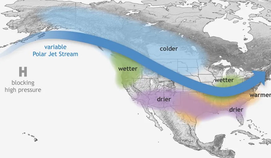
A La Niña winter usually means dry, warmer-than-average conditions across the southern half of the country. Past La Niña years have contributed to severe drought conditions in California and the Southwest.
Meanwhile, the Pacific Northwest and Ohio Valley tend to get more precipitation, and northern states can see extra-cold weather.
Copyright 2024 Nexstar Media Inc. All rights reserved. This material may not be published, broadcast, rewritten, or redistributed..


