This winter’s El Niño could be one of the strongest in 70 years. What does it mean for you?
(NEXSTAR) – The 2023-2024 El Niño is growing more likely to be one for the record books.
In an update released Thursday, the Climate Prediction Center said this winter’s El Niño was slightly favored to be “historically strong.” The national forecasters gave it about a 54% chance of being one of the five strongest since 1950.
Those odds are up from last month, when the Climate Prediction Center gave this year’s El Niño a 35% chance of being among the strongest ever, like the one we saw 2015-2016 or 1997-1998.
But a super-strong El Niño doesn’t necessarily mean super-strong impacts, like storms, flooding or heavy snow. “While stronger El Niño events increase the likelihood of El Niño-related climate anomalies, it does not imply expected impacts will emerge in all locations or be of strong intensity,” says the Climate Prediction Center.
What are they expecting to happen this winter? As with any weather, it depends on where you live.
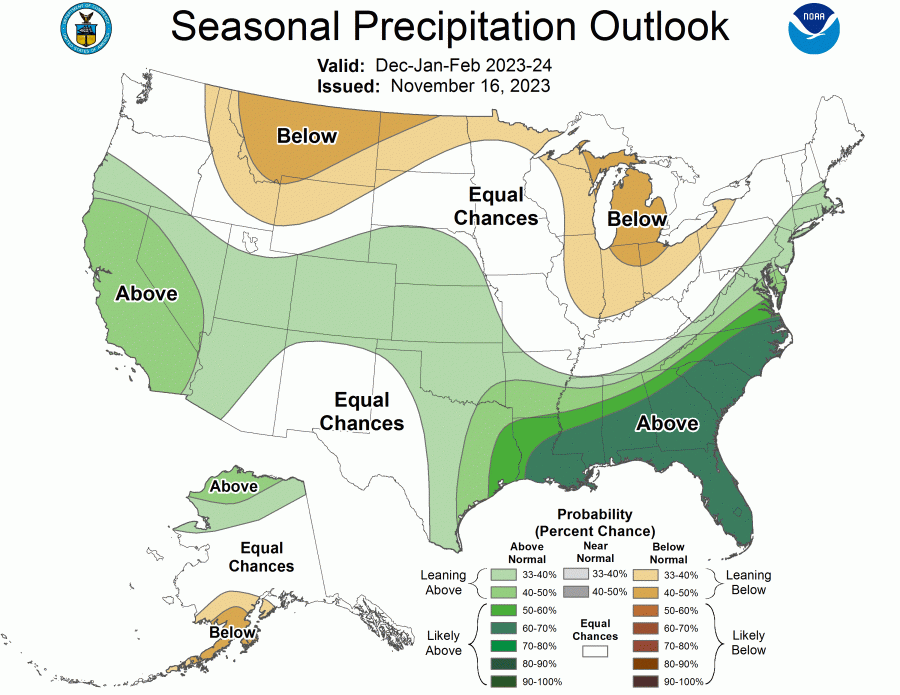
The precipitation outlook for December, January and February looks pretty consistent with a typical El Niño winter: more rain for the southern half of the country, and drier weather for a few northern and Great Lakes states.
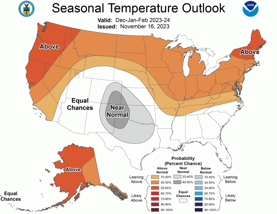
The winter temperature outlook, meanwhile, isn’t looking particularly wintry. More than half of states are likely to a see a warmer-than-average season, according to the latest outlook.
Whether we’re in a La Niña year, El Niño year, or neither is determined by sea surface temperatures near the equator over the Pacific Ocean. The temperature of the water and air above it can shift the position of the jet stream, which in turn impacts the types of weather observed on land.
Copyright 2024 Nexstar Media Inc. All rights reserved. This material may not be published, broadcast, rewritten, or redistributed.